Maps are updated everyday at 5:00 am and are generated from the ERA5 reanalysis hourly data. They correspond to the conditions from 6 days ago due to the availibility of ERA5 data.
Daily FWI map
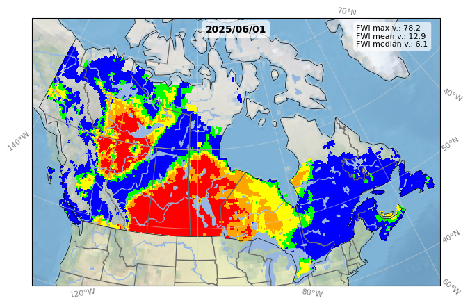
The Fire Weather Index (FWI) is calculated daily using the ERA5 hourly reanalysis.
Daily FWI records maps
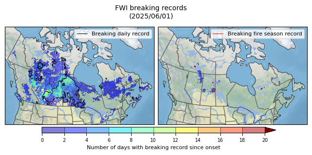
Record maps in FWI values show the locations (black or red outlines) where the daily FWI value for the last calculated day exceeded historical records (since 1950), as well as the number of days since the start of the current fire season where record daily values have been observed (base map).
The map on the left represents the records relative to the same day (on this same date), while the map on the right represents the records relative to all daily values observed during the fire season.
FWI
- Extreme (>30)
- Very high (20-30)
- High (10-20)
- Medium (5-10)
- Low (0-5)